The National Weather Service confirmed that the storms we had in Chicago yesterday resulted from a derecho:
August 11th was a very active day with multiple rounds of severe weather. A cluster of strong to severe storms impacted northwest and north central Indiana in the morning around the US 30 corridor, dropping hail the size of baseballs in Starke County, IN! By late morning, a strong MCS was observed quickly moving east through northern Illinois. This line of storms produced destructive damaging wind gusts up to 100 mph in far NW Indiana! In our forecast area, La Porte, Starke, Marshall, and St Joseph (IN) counties saw the most damage with wind gusts of up to 75 mph. This system rapidly weakened as it moved into north central Indiana, with wind damage reports becoming much more sporadic. In addition to the severe weather, repeated heavy rainfall over the same areas caused flash flooding.
The MCS that moved from eastern Iowa to northern Indiana today has been preliminarily confirmed as a derecho. Based on the preliminary information thus far it began around 12Z [7 am CDT] this morning and continued to at least 1725 UTC [10:25 CDT] (although will be evaluated later if the continuation to near Cincinnati may be included). The maximum measured gust received thus far was 86 kts (99 mph) in Gary, Indiana. Just a reminder that official 2026 derechos will be confirmed in 2027 once 2026 storm data has been finalized, but events such as this where we feel confident to confirm it as a preliminary derecho will likely have no problem maintaining the objective criteria once final storm data is released.
Gary may have recorded a 160 km/h gust but they didn't send the data to Asheville. Aurora, Ill., also stopped transmitting weather data immediately after recording a 137 km/h gust.
Even as these areas are putting the pieces back together from yesterday, look what's about to hit us this morning:
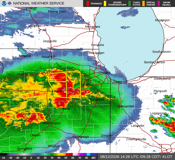
It's so bad this year that Illinois could soon break the record for the most tornadoes in any state in a single year:
In the coming days, the National Weather Service will survey the damage and confirm how many tornadoes were seen Tuesday in Illinois. Each confirmed tornado will add to the growing total in the state, which shattered its yearly record over six weeks ago.
If Illinois continues this stormy trend, it may not only add to its state record but perhaps break a nationwide record for the total number of tornadoes in one state in any single year — 232 tornados in Texas in 2015 and 1967.
“There’s no question that we’re getting warmer,” [WGN-TV meteorologist Bill] Snyder said. “Gulf of Mexico temperatures continue to escalate. That sends more water vapor into the atmosphere. Our warmer winters in Chicago lead to a very active spring.”
Fun times, fun times...
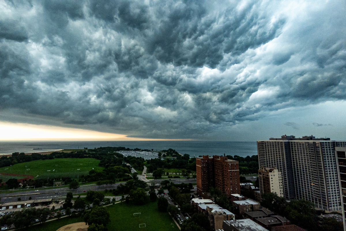
Update, 11:03 am: This morning's line of storms missed my part of the city by a comfortable margin, and looked really cool doing so:
Copyright ©2026 Inner Drive Technology. Privacy. Donate!